↓
 

Birmingham Land Surveying

Birmingham Land Surveying
  • Home
  • ALTA Title Survey
  • Boundary Surveying
  • Drone LiDAR Mapping
  • Elevation Certificate
  • Land Surveying
  • Lot Survey – Mortgage Survey – Closing Survey
  • Topographic Survey | Topo Survey
  • Blog
  • Contact Us
Home

Urban Property Dispute Resolution Using Certified Boundary Survey Evidence

Birmingham Land Surveying Posted on July 2, 2026 by BirminghamSurveyorJuly 2, 2026
Aerial view of land parcel showing surveyed boundary lines across agricultural fields used for subdivision planning and topographic mapping analysis

A certified boundary survey often decides the outcome when two urban property owners argue over where one lot ends and the next begins. In tight neighborhoods and busy commercial blocks, even a few inches of disputed ground can stall a project or split neighbors apart. This survey turns a guess into a documented fact that a licensed professional signs and stands behind. The sections below show how these disputes start, why certified evidence matters and how owners settle things once the true line reaches paper.

Escalation Patterns That Lead to Urban Property Boundary Disputes

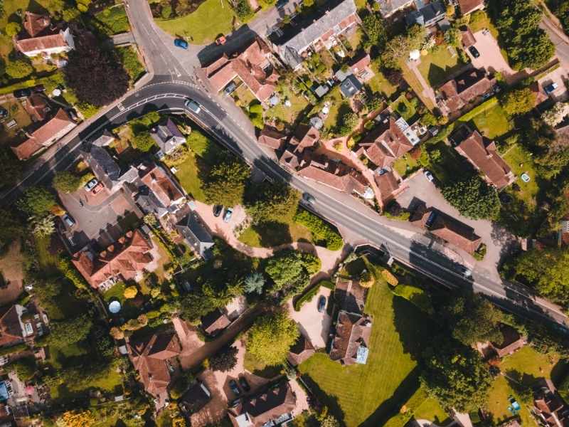
Most urban boundary disputes start small. A homeowner assumes an old chain-link fence marks the true line. Two neighbors share a driveway and never check who owns which strip of pavement. Trouble shows up only when someone decides to build, pave or replace something along that edge.

Dense areas make the problem worse because space runs short. When lots sit close together, a wall or addition that drifts even a little can cross onto land someone else pays taxes on. A few common triggers cause most of these fights:

  • Faded or missing lot markers that hide the real corner
  • Shared driveways, walls or alleys with no clear owner on record
  • New construction that pushes past the space the owner holds
  • Old assumptions passed between owners that never matched the deed

Once one side feels wronged, things harden fast. A calm talk turns into letters, then lawyers and sometimes a complaint to the city. Urban land carries high value per square foot, so a small gap can grow into a costly standoff.

Role of Certified Boundary Survey Evidence in Legal Property Verification

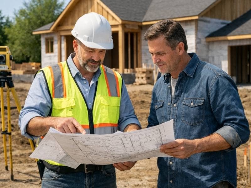
A certified boundary survey holds legal weight because a licensed surveyor prepares it, signs it and stamps it with a professional seal. That seal means the surveyor stands behind the numbers and takes responsibility for them. Courts, title companies and city offices treat the document as solid proof of where a line sits.

Informal measurements do not earn that trust. A neighbor’s tape reading, a sketch drawn from memory or a line marked by an old fence can all be wrong. No official office has to accept them. A certified survey follows state standards and ties the property to fixed points. Another qualified surveyor can then check the work and reach the same result. That repeatable quality turns a private opinion into evidence a judge or planner will use.

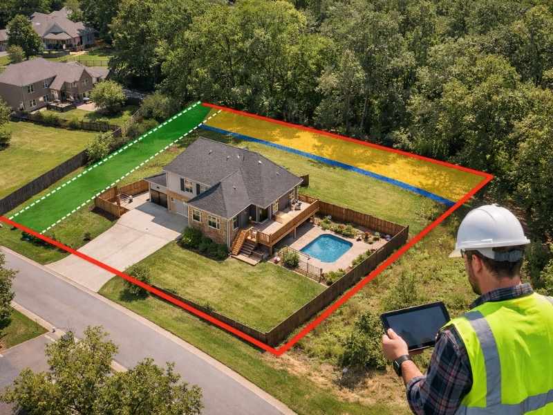
Comparative Analysis Between Recorded Property Data and Physical Site Conditions

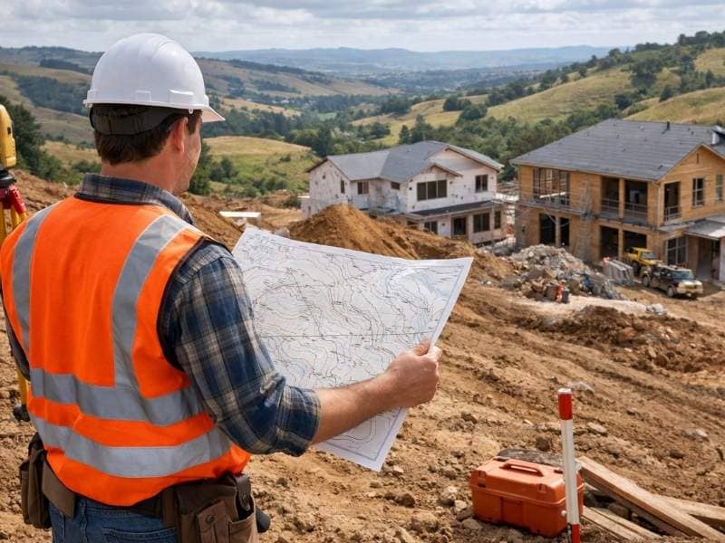
To find the real line, a surveyor pulls every written record tied to the parcel. Then the surveyor compares those records against what stands on the ground today. The paperwork usually holds the deed’s legal descriptions, subdivision maps filed with the county and municipal records that mark easements or right-of-way lines.

The next step moves outside. The surveyor finds the existing corner markers, measures the distance between them and checks whether walls and pavement match the recorded numbers. Trouble appears when the paper and the pavement disagree. A subdivision map might place a line six inches from where a garage wall really sits. A driveway might run wider than the records allow. These gaps between record and reality are what a surveyor tracks down, since they usually sit at the root of the dispute.

Resolution Pathways Based on Verified Survey Findings in Urban Environments

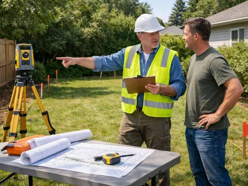
Once certified data lands on the table, the argument shifts from opinion to fact. That shift opens several routes to a settlement. In many cases the two owners simply sign a boundary line agreement, record where the line sits and file it with the county. The matter then rarely troubles them again.

When a structure already crosses the line, owners often reach a negotiated settlement instead. One side might grant a small easement, adjust a plan or trade a narrow strip of land. That way the paperwork matches what stands there now. The surveyor then updates the records to match the deal, which keeps the fix official.

Some cases still need the city. Municipal review starts when a fix calls for a lot-line change, a variance or a permit. The local planning office checks the certified survey before it approves anything. Strong evidence tends to speed that review, since planners trust clear numbers over conflicting claims.

Long-Term Dispute Prevention Through Updated Certified Boundary Documentation

Cities change faster than property records do. Buildings come down, new ones go up and lots trade hands every few years. A current certified survey gives an owner a clear reference point each time the block shifts.

Updated records also spare the next owner from inheriting an old fight. When a property sells, a recent survey shows the buyer exactly what they get. That stops a hidden overlap from surfacing later during a remodel or a loan review. In areas where redevelopment moves fast, that head start can save months of back-and-forth for whoever comes next.

Frequently Asked Questions

What makes certified boundary survey evidence legally stronger in property disputes?

Legal strength comes from the surveyor’s license and the professional seal on the finished document. A licensed surveyor must follow state rules and answer to a licensing board. That oversight means the work meets a standard courts already accept, which sets a stamped survey apart from any measurement an owner takes alone.

Can boundary disputes be resolved without going to court if survey evidence is clear?

Yes, most clear cases settle long before a courtroom. When a certified survey clears up the doubt, owners often reach a boundary agreement. Some work through a mediator who helps both sides accept the same facts. Court usually becomes the path only when one owner refuses to accept solid evidence.

How do urban property disputes differ from rural boundary conflicts?

Urban disputes center on tight spacing and shared features like driveways, walls and alleys, where a few inches carry real money. Rural conflicts usually spread across open land, where old markers sit far apart and few structures crowd the line. City lots pack so much into a small area that even a minor overlap can touch several owners at once.

What happens if two surveys show different boundary interpretations for the same property?

When two surveys disagree, a third surveyor or a formal review often steps in to study the methods and evidence behind each one. The reviewer weighs which survey used stronger corner evidence and followed proper standards, and the more defensible result stands. In some cases the owners order a fresh survey that settles the question with new fieldwork.

Who typically requests certified boundary survey evidence during a dispute?

Homeowners request it when a neighbor challenges a fence, wall or addition. Attorneys order it to back a client’s position. Developers rely on it before building near a shared line. City planning departments ask for it when a permit depends on the true boundary. Each group needs a document it can defend, which is why the certified version matters.

Posted in boundary surveying | Tagged boundary survey

How Much Does a Property Survey Cost?

Birmingham Land Surveying Posted on June 26, 2026 by BirminghamSurveyorJune 15, 2026
Land surveyor reviewing plans and using a total station at a commercial construction site.

Property survey cost ranges from $300 to $5,000 or more, depending on property size, terrain, survey type, and the condition of existing records. Most residential boundary surveys fall between $500 and $1,500. Commercial surveys run higher.

If you’re buying land, settling a boundary dispute, or pulling a building permit, knowing what to expect before you get the quote saves you from sticker shock. Here’s what actually drives the price.

Factors That Influence the Cost of a Property Survey

A surveyor’s time is the main input. Anything that adds hours to the job adds cost, and several things do.

Size is the most direct factor. A quarter-acre city lot wraps up faster than a 10-acre rural tract. More ground means more field time, more measurements, and more office work to process everything afterward.

Terrain is the one people underestimate. A flat subdivision lot is straightforward. A wooded hillside with a creek running through it is not. Some jobs take twice as long simply because of what’s on the ground.

Records matter more than most buyers realize. If the county has a clean survey on file from 15 years ago, the surveyor starts ahead. If the last recorded plat is from 1952 and the deed references a fence post that no longer exists, research alone can eat up a full day.

Access is the quiet wildcard. A property with a locked gate, an easement dispute, or terrain that requires equipment beyond a standard truck will cost more to reach and document.

Why Different Survey Types Have Different Price Ranges

Not all surveys serve the same purpose, and the level of detail required drives the price more than almost anything else.

A boundary survey is what most residential buyers and homeowners need. It confirms property lines and establishes legal corners. For a standard residential lot, it typically costs between $300 and $1,500.

A topographic survey goes further. It maps elevation changes, drainage patterns, and physical features across the land. Builders and engineers order these before breaking ground. Cost usually falls between $500 and $2,000, though larger or complex properties push that higher.

An ALTA/NSPS survey is the most detailed option. Lenders and title companies require it for complex transactions because it meets nationally standardized specifications. Cost runs from $2,000 to $5,000 or more, sometimes considerably higher for larger parcels.

The price difference isn’t arbitrary. An ALTA survey demands more research, more field time, and a licensed surveyor who signs off on far stricter deliverables than a basic boundary check requires.

How Property Features Can Raise Survey Expenses

Certain site conditions make the work harder, and that shows up in the final bill.

Wooded lots are the most common complication. Before measurements can even start, the crew has to cut sight lines through trees and brush. That’s preparation, not surveying. It still takes time.

Irregular lot shapes, odd angles, and curved boundaries require more calculation. A standard rectangle is simple. A 12-sided irregular parcel takes longer to close mathematically.

Water features, including streams, ponds, and drainage easements, affect where legal boundaries fall. Figuring out that relationship requires analysis beyond standard fieldwork.

Missing property monuments create a different kind of delay. When the corner markers that define a boundary are gone or disturbed, the surveyor has to reconstruct their position from older records and neighboring evidence before the main work can begin. That adds hours before a single measurement is taken.

Steep slopes slow every part of the process and sometimes require specialized equipment. If several of these conditions exist on one property, the quote will reflect all of them.

What’s Included in the Price of a Professional Land Survey

The field visit is the visible part of a survey. Most of the work happens before and after it.

Before the crew arrives, the surveyor pulls deeds, reviews historical plats, and examines county records to piece together the legal history of the parcel. For older or complicated properties, this stage takes as long as the fieldwork itself.

On-site, the crew measures distances, checks angles, locates existing monuments, and collects the raw data needed to establish or confirm boundary lines.

Back in the office, that data gets analyzed and drafted into a plat or survey map. That’s the legal drawing showing the property’s boundaries, dimensions, and any easements or encroachments. Many surveys also include a written legal description, which is used in deeds, permits, and title insurance policies.

That’s what property survey cost actually buys. Not a quick walk around the yard.

How to Budget for a Property Survey Before Buying or Building

Order early, come prepared, and confirm what type of survey is actually required before you schedule anything.

When you contact a surveyor, have the property address, approximate acreage, the purpose of the survey, and any known issues ready. Disputed lines, missing monuments, access restrictions the more detail you give up front, the more accurate the quote will be.

Get at least two quotes. Prices vary between firms, and comparing a few gives you a realistic sense of what the job should cost for your specific property.

One step many people skip: check with your lender or local building department before ordering. Some transactions require a specific survey type. Paying for the wrong one means paying twice.

Frequently Asked Questions

How much does a property survey typically cost? 

Most residential surveys fall between $300 and $2,000. Boundary surveys for standard lots tend to land between $500 and $1,500. ALTA/NSPS surveys for commercial transactions often exceed $5,000.

What factors affect the price of a property survey? 

The main drivers are property size, survey type, terrain difficulty, the quality of existing records, and site accessibility. Any condition that adds time to the job adds to the cost.

Does property size affect survey cost? 

Yes. Larger parcels take more time in the field and more time in the office to process. Size is consistently one of the biggest cost variables, though it’s rarely the only one.

Can difficult terrain or missing markers raise the cost?

Yes, and sometimes by a significant amount. Wooded land, steep slopes, water features, irregular boundaries, and missing or disturbed monuments all add time. In some cases, these complications can double the base cost of a standard survey.

What does the cost of a professional property survey include? 

It covers records research, field measurements, boundary analysis, and preparation of a legal plat or survey map. Most surveys also include a written legal description for use in deeds, permits, and title documents.

Posted in boundary surveying | Tagged boundary survey

Construction Surveying Becomes More Important When Projects Refuse to Stay Simple

Birmingham Land Surveying Posted on June 22, 2026 by BirminghamSurveyorJune 18, 2026
Construction crews reviewing framing changes and coordinating adjustments as the project evolves.

Some projects finish exactly the way they were drawn. Most don’t. A wall moves six feet. A client wants a second entrance. The grade turns out to be nothing like what anyone expected. Construction surveying was already part of the plan before any of that happened, but by the time a project starts growing in directions nobody fully anticipated, it becomes the thing that holds everything together.

The Original Plan Rarely Gets the Last Word

Every project starts on paper, and on paper, everything fits. The lines are clean, the numbers add up, and the sequence makes sense. Then the first crew shows up and the site has other ideas.

Soil conditions change what’s possible underground. A neighbor’s property line sits closer than the early sketches assumed. The client walks the site for the first time and asks whether the building could shift slightly to catch a better view. None of these things are failures. They’re just reality showing up to the meeting, and the project has to respond.

This is normal. Anyone who’s worked on a real construction project for more than a week already knows this. Plans are starting points, and good teams treat them that way, staying flexible enough to adapt without losing track of where the project is supposed to land.

Complexity Usually Arrives One Decision at a Time

Nobody wakes up and decides to make a project complicated. It happens gradually, one reasonable choice at a time, and by the time anyone notices, the original design has collected a dozen additions that weren’t part of the first conversation.

A retaining wall gets added to handle a grade problem. Then a second access point gets drawn in to improve traffic flow. Then the building footprint shifts slightly to accommodate a mechanical room that didn’t exist in the original program. Each of those decisions made sense on its own. Together, they’ve changed the project considerably, and every change has to be measured, documented and reflected in how the site is laid out.

This is where construction surveying earns its place. Every adjustment on a project has a physical location attached to it, and that location has to be established accurately before work can proceed. As decisions accumulate, so does the need for reliable reference information on the ground.

Bigger Projects Often Grow Out of Smaller Ideas

A lot of the most interesting built projects started out as something much smaller. A single building becomes a campus. A simple access road turns into a full site with parking, drainage infrastructure and lighting. An owner who initially wanted a modest structure starts seeing what’s possible once the land gets cleared and the footprint gets staked out.

Growth like that isn’t a problem. It’s often a sign that a project is going well, that the owner has confidence in what’s being built and wants more of it. What changes is the level of coordination required to keep everything accurate as the scope expands.

More area to cover means more reference points to establish and verify. More trades working simultaneously means more chances for one crew’s work to affect another’s. A project that started small but grew into something larger needs the same quality of survey control as a large project that was always planned that way.

Good Coordination Becomes More Valuable as Plans Evolve

When a project is simple, coordination is easy. There aren’t many moving pieces, the sequence is clear, and everyone knows what comes next. When a project grows or changes direction, coordination gets harder fast.

Different contractors work from different reference points if nobody establishes a common framework. A foundation crew and a utility crew can both be working from their own measurements and still end up three feet apart from where they need to be. On a small project with forgiving tolerances, that might not matter much. On anything larger or more precise, it creates rework.

Construction surveying gives every crew on the site a shared reference system to work from. These are some of what that coordination typically covers as a project evolves:

  • Updated control points when site conditions or design changes shift the original reference framework
  • Layout verification at key stages before work that’s hard to reverse gets locked in
  • Grade checks to confirm that drainage and finished surfaces match the design as it stands now, not as it stood six months ago
  • Documentation of field changes so the record reflects what was actually built

The value of that shared reference grows as the project does. The more people working, the more it matters that they’re all working from the same numbers.

Finished Buildings Tell a Longer Story Than Blueprints

A completed building doesn’t show you every decision that went into it. It shows you the result. The wall that moved, the entrance that got added, the footprint that shifted two feet to the east, none of that is visible once everything is finished and occupied. What’s visible is a structure that works, or one that has problems nobody caught in time.

The difference between those two outcomes often comes down to how well the project tracked its own changes. Construction surveying keeps a running record of where things are as the project evolves, so the final product reflects all the decisions that shaped it rather than just the ones in the original design. That matters most when a project has grown well past what anyone initially sketched out, because at that point, the blueprints are a starting point and not much more.

Frequently Asked Questions 

Why do construction projects often become more complicated over time?
Changes in priorities, site conditions and design adjustments add up gradually, and each one requires the project to adapt and track the new information accurately.

Does a larger project always begin with a large plan?
No, many developments start with straightforward ideas that expand as owners and builders see new possibilities once work is underway.

Why is coordination important during construction?
When multiple crews work from different reference points, small gaps can compound into costly errors. Good coordination keeps everyone working from the same verified information.

How does construction surveying support evolving projects?
Construction surveying provides updated, accurate reference information as designs change, so teams can adapt without losing track of where everything needs to land.

Is changing a project always a sign of problems?
No. Many successful projects evolve as owners refine their goals and teams respond to real site conditions. What matters is that changes get tracked and managed accurately.

Posted in construction surveying | Tagged land surveying

How Land Surveying Helps Properties Keep Up With Changing Neighborhoods

Birmingham Land Surveying Posted on June 19, 2026 by BirminghamSurveyorJune 18, 2026
Aerial view of an established neighborhood with mature trees and diverse homes reflecting gradual community growth over time.

Neighborhoods change, and most homeowners don’t notice until it’s already happened. Land surveying gives owners a clear picture of what they actually have, so when the area around them shifts, they’re not making plans based on guesses. That matters more than most people think before they start a project.

A Neighborhood Never Stands Still

Drive through any older area and you’ll see it. A vacant lot now has a house on it. A small business closed and something bigger moved in. A street that used to be quiet now carries twice the traffic it did ten years ago. These changes don’t announce themselves. They just happen, one small thing at a time, until the neighborhood feels like a different place.

Most homeowners who’ve lived somewhere for years are the last to notice this. They’ve seen each change happen slowly, so nothing feels dramatic. But step back and look at the full picture, and the neighborhood they moved into often looks very different from what’s there today.

What Worked Twenty Years Ago May Not Match Today’s Priorities

When someone bought their home two decades ago, they made choices based on what the area looked like then. The yard was the right size. The layout made sense. The property fit their life at the time.

Things shift. As the neighborhood fills in and home values climb, owners start thinking about things they never considered before. Maybe the backyard that worked fine for years now feels like wasted space. Maybe there’s an old detached garage sitting exactly where a future addition would go. What feels like more than enough room can start to feel limiting once the area around it changes and new ideas start to feel possible.

Land surveying ties those new ideas to what’s actually on the ground. A plan only works if it matches the real conditions of the property, not what the owner assumes those conditions are.

Properties Often Respond to Their Surroundings

When a neighborhood starts improving, individual owners tend to follow. A street gets new sidewalks and suddenly a front porch renovation feels worth doing. A neighbor puts up a clean addition and the question comes up naturally, could something like that work here too?

That’s a normal response. Community investment pulls individual investment along with it. The problem shows up when owners start making plans without checking the facts first. Where does the recorded boundary actually sit? Are there easements running through the area where new work is planned? How does the lot drain, and would that change if a new structure went up? These questions sound simple, but the answers aren’t always what owners expect, and finding out late costs far more than finding out early.

Change Brings Opportunities Along With Questions

A neighborhood that’s growing tends to make homeowners think longer term. Resale value starts to feel relevant. Plans that felt far off start to feel closer. Owners who had no interest in improvements a couple of years ago find themselves sketching out ideas and wondering if the property can support them.

This is where land surveying becomes genuinely useful, because it answers the questions that have to come before any real plan can take shape:

  • Where recorded property lines sit compared to the existing fence or landscaping
  • Whether any easements cross through areas where new work is being considered
  • How the lot handles water and whether grading would need to change
  • What setback rules actually mean for the specific size and shape of the lot

Getting those answers early keeps a project on track. Skipping them and finding out later is how projects stall or have to be redesigned from scratch.

Staying Connected to the Future Without Losing the Past

A changing neighborhood doesn’t ask anyone to start over. Plenty of older homes sit in areas that have shifted a lot around them and still feel like themselves. Mature trees. Original proportions. A sense of history that newer construction can’t replicate. Owners who hold onto that while still adapting aren’t doing anything complicated. They just know what they have.

That’s what land surveying supports. It gives owners accurate, documented information about their property so that any changes they make actually fit what’s there. The neighborhood will keep moving forward no matter what any single owner decides. But the ones who understand their property clearly are in a much better position to decide what role they want to play in what comes next.

Frequently Asked Questions 

Why do neighborhoods change over time?
New residents move in, older properties get updated and local investment shifts the feel of an area gradually over many years.

Can neighborhood growth affect what a homeowner decides to do with their property?
Yes, when the surrounding area improves, owners often start thinking more seriously about additions, outdoor spaces and long-term plans they’d put off before.

Why is land surveying useful in an established neighborhood?
It gives owners current, accurate information about their property, which matters most when new plans are on the table and assumptions can’t be trusted.

Do older homes have to change just because the neighborhood around them does?
No, owners can update their properties on their own terms and keep the features they value, as long as any changes are based on real information about what the property can support.

How does land surveying help with long-term ownership?
It documents existing conditions clearly so owners can plan with confidence, whether a project is happening now or years from now.

Posted in land surveying | Tagged land surveying

Property Easements Explained for Birmingham Landowners

Birmingham Land Surveying Posted on June 19, 2026 by BirminghamSurveyorJune 8, 2026
Aerial view of a Birmingham home showing property boundaries and a utility easement identified during an easement survey

If you own property, there is a good chance an easement runs across part of it. Many owners never find out until they try to build, sell, or dispute access with a utility company. Knowing what easements are, how they work, and how an easement survey documents them can protect your land from costly surprises.

What Is an Easement?

An easement gives someone other than the owner the right to use part of a property for a set purpose. The owner keeps the land. The easement holder gets a limited right to use that part of it.

In Alabama, an easement is a non-possessory interest in real property. The holder does not own the land. They only have the right to use it for the purpose the agreement describes or the law establishes.

Most easements are permanent. They stay attached to the property when ownership changes. A buyer who skips checking for easements before closing can inherit restrictions they never agreed to.

Common Types of Easements

Utility easements are the most common type. They let power companies, water authorities, gas providers, and telecom companies install and maintain lines across private land. Landowners with utility easements cannot build over the corridor or block access to the equipment.

Access easements, also called right-of-way easements, let a person or the public cross one property to reach another. They are common when a parcel has no direct road access. Alabama law recognizes that landlocked owners have the right to reach a public road through neighboring land.

Drainage easements give a municipality or neighboring property the right to direct water across a parcel. They are common near creeks, ditches, or storm drainage systems. Building within a drainage easement can block water flow and cause legal problems.

Prescriptive easements are different. They are not written agreements. They arise when someone uses part of your land openly and continuously, without your permission, for long enough. In Alabama, that period is 20 years under Alabama Code Section 6-5-200. If someone crossed a corner of your land for two decades and you never stopped them, they may have gained a legal right to keep doing so.

How Easements Are Recorded and Found

Most formal easements in Jefferson County are recorded at the Jefferson County Probate Court. The Probate Court Land Records office keeps easement deeds, right-of-way agreements, and subdivision plats that affect real property.

When a title search is done before a sale, recorded easements should appear. But not every easement shows up in a title search. Prescriptive easements and easements by implication may not be written down anywhere. They can exist based on how the land has been used over time, with nothing in the probate records.

That is where an easement survey becomes important.

What an Easement Survey Does

An easement survey is performed by a licensed land surveyor. It locates and maps recorded easements on the ground, showing exactly where they fall within the property’s boundaries.

The surveyor reviews easement documents from the probate records, then visits the property. They look for physical evidence such as utility poles, buried line markers, drainage structures, or worn paths. They measure the width and position of each easement corridor and show it all on a survey map.

That map tells you where you can and cannot build, place structures, or make improvements. A document tells you an easement exists. A survey tells you exactly where it sits on your land.

Why Easements Matter Before You Build or Buy

A fence, shed, or addition placed inside a utility or drainage easement can be required to come down at your expense. The easement holder has the right to remove anything that blocks their access. A survey done before construction prevents that situation.

When buying property, knowing where easements are affects how you plan to use the land. An easement through the middle of a lot limits where a house can sit. A drainage easement along the rear may rule out a pool or garage. A title report alone may not show this clearly. A field survey shows the physical reality.

Easements also affect property value. A parcel with a large utility corridor running through it has less usable area than the lot size suggests. Knowing this before a transaction protects buyers and sellers.

Frequently Asked Questions

Can an easement be removed from my property?

In Alabama, easements can end in a few specific ways. If one person comes to own both the land the easement benefits and the land it crosses, the easement ends by merger. An easement by necessity ends when the need is gone, such as when a new road gives a landlocked parcel access. Ending an easement by abandonment requires clear evidence of intent to give up the right. Not using it for a period of time is generally not enough.

Does a recorded easement always show up in a title search?

Not always. Recorded easements in Jefferson County are kept at the Probate Court and should appear in a standard title search. Prescriptive easements and easements by implication may not be in the written record at all. A field survey by a licensed surveyor is the most reliable way to find all easements on your property.

Can I build a fence across a utility easement?

Generally, no. Most utility easements prohibit structures that block access to the corridor. Some allow a fence with a gate the utility company can open, but that depends on the specific easement terms. Building across a utility easement without reviewing those terms first creates legal and financial risk.

What is the difference between an easement and a right of way?

A right of way is a type of easement. It grants the right to travel across a piece of land. All rights of way are easements, but not all easements are rights of way. Utility, drainage, and conservation easements are other types that do not involve crossing the land.

How does an easement survey differ from a boundary survey?

A boundary survey establishes the legal limits of a property. An easement survey locates and maps the recorded easements within those limits. It shows where each corridor sits on the ground. Both are done by licensed land surveyors but serve different purposes. Many landowners need both when planning construction or a property transaction.

Posted in boundary surveying | Tagged boundary survey

What Is a Topographic Survey and When Do You Need One?

Birmingham Land Surveying Posted on June 17, 2026 by BirminghamSurveyorJune 7, 2026
Surveyor reviewing a topographic survey map on a sloped residential construction site

A topographic survey is a detailed map of a property’s surface. It records elevation changes, slopes, and physical features such as trees, buildings, and utility lines. Engineers and architects use this data to design buildings, plan grading, and manage water flow before building begins. Without it, design decisions are based on guesswork. And guesswork leads to costly problems in the field.

A topographic survey goes beyond where your property lines are. It answers a different question: what does the land look like, and how will that affect what you build?

What a Topographic Survey Captures

A topographic survey collects two types of information: elevation data and physical features.

Elevation data shows up on the final map as contour lines. Each line connects points at the same height. Lines close together mean a steep slope. Lines far apart mean flatter ground. Most home surveys use a one-foot or two-foot contour interval. Each line marks a one or two-foot change in height.

Physical features recorded during the survey include buildings, fences, driveways, trees, utility lines, drainage channels, streams, and retaining walls. Anything on or near the site that could affect design or building work is documented.

The final product is a topo map. Engineers and architects get both a printed version and a digital file. The digital file lets them build a 3D model of the land. They use that model to design grading plans, drainage systems, and building layouts.

Why This Data Matters for Building in Birmingham

Birmingham, Alabama has varied terrain. The area has rolling hills, ridges, creek corridors, and low spots with drainage challenges. That terrain directly shapes how sites are designed and built.

When an engineer gets a topographic survey, the elevation data shows where a building should sit on the lot. It also shows how much soil needs to move and how to grade the site so water drains away from structures. This process is called cut and fill.

The survey shows the current ground surface. The engineer designs the final surface. The gap between the two tells them how much earthwork the project needs. Getting this wrong is one of the most costly mistakes on a building project. Moving too much or too little soil adds time and money that were not in the budget.

Drainage matters just as much. Poor drainage leads to water pooling near foundations, erosion, and long-term damage. A topographic survey maps how water moves across the site. That gives engineers what they need to design systems that work with the land rather than against it.

When You Need a Topographic Survey

Not every project needs a topographic survey, but many do.

New home construction on a sloped or uneven lot. Flat lots in new subdivisions may not need one. Any site with a noticeable slope needs topographic data before design begins.

Site improvements and additions. Adding a garage, driveway, or pool may require topographic data if it changes the grading or drainage of the property.

Commercial and residential development. Projects going through the permit process in Jefferson County or Birmingham will often need a topographic survey as part of the site plan.

Drainage and flooding concerns. If a property has drainage problems or sits near a creek, a topographic survey records the current conditions. Engineers use that data to design a solution.

Land subdivision. When a parcel is divided, engineers need to know the terrain to plan roads, drainage, and utilities for each new lot.

How a Topographic Survey Is Done

Topographic surveys are done by a licensed land surveyor using field equipment and, in many cases, aerial tools.

Traditional ground surveys use GPS and robotic total stations to collect elevation points across the site. The crew records the height and location of each point. That data is then processed in the office into a contour map and terrain model.

For larger or heavily wooded sites, drone-mounted LiDAR is often used. LiDAR sends laser pulses toward the ground and measures how long they take to return. This captures ground elevations even through tree cover. Drone surveys collect large amounts of data quickly, making them a good fit for bigger or more complex sites.

Topographic surveys for home lots typically cost between $1,500 and $3,000. Larger or more complex sites range from $3,000 to $6,500 or more. For sites over two acres, drone surveys can cut costs by 30 to 50 percent compared to traditional ground methods.

Posted in topographic surveying | Tagged topographic survey

How to Find Property Lines Before Installing a Fence or Shed

Birmingham Land Surveying Posted on June 15, 2026 by BirminghamSurveyorJune 8, 2026
Licensed surveyor and homeowner reviewing a property line survey before installing a backyard fence and shed

Installing a fence or shed seems simple. Pick a spot, get the materials, and start building. But skip one step first and the whole project can go wrong. That step is a property line survey. Knowing where your property ends before you build keeps you from putting a structure on the wrong land. In Birmingham, that mistake can cost more than the project itself.

Most homeowners think they already know where their lines are. They point to an old fence, a row of hedges, or a rough sense of where the yard ends. None of those are legally reliable. A property line survey is the only way to know for certain.

Why Existing Markers Can Mislead You

Fences, hedges, and driveways are not legal boundary markers. They were placed at some point in time, often by people making the same assumption you might make now.

Over the years, those markers shift. Fences lean or get moved. Hedges grow past their original spot. Driveways get widened. None of these changes appear in the county’s legal records.

A property line survey goes back to the legal record. It uses your deed, recorded plats, and physical monuments to find where the boundary actually sits. What you see in your yard may or may not match that.

What a Property Line Survey Involves

A property line survey is done by a licensed land surveyor. It is not the same as a quick online search or a measurement you take yourself.

The surveyor starts by researching your property’s legal history. This includes reviewing the deed and checking Jefferson County records. That research shows how the land has been described legally and where any boundary issues might exist.

The survey crew then visits the property. They search for corner monuments, take precise measurements, and compare what they find on the ground to what the records show. If a corner monument is missing, the surveyor figures out where it should be and places a new one.

At the end, you get a sealed survey document showing your confirmed property lines. That document is legally valid. You can use it for permits, neighbor disputes, or any future transaction.

Birmingham Fence Rules You Need to Know

In Birmingham, a zoning permit is required before any fence or wall goes up on any property within city limits. This applies to all fences, no matter the height or material.

The city also sets height limits for residential properties. Front yard fences cannot exceed four feet. Side and rear yard fences can reach up to eight feet. For taller fences in the side or rear yard, there must be at least a five-foot setback from the neighboring lot line.

Your permit application needs a site plan showing where the fence will sit in relation to your lot lines. That is why a property line survey should come before the permit, not after.

Properties in a floodplain or historic district may need extra reviews before a fence permit is approved.

What About Sheds?

Sheds follow different rules than fences in the Birmingham area. In unincorporated Jefferson County, a building permit is required for any accessory structure 200 square feet or larger. Smaller sheds may not need a permit, but they still must meet setback requirements for your zoning district.

Those setback rules tell you how far the shed must sit from your property lines. Without a confirmed property line survey, you have no reliable reference for placing the shed correctly. A shed too close to the boundary can be flagged during inspection, require relocation, or start a dispute with a neighbor.

Check your specific zoning district requirements before you build. The rules vary depending on whether your property is in the city of Birmingham, unincorporated Jefferson County, or a surrounding municipality.

Why Calling 811 Is Also Part of the Process

Before any digging, Alabama law requires homeowners to call 811. This is the state’s utility locate service. It sends technicians to mark buried gas, water, cable, and power lines on your property.

A property line survey does not find underground utilities. The two services work together. The survey shows where your legal boundary is. The 811 call shows what is buried below the surface. Both steps should happen before any post goes into the ground.

Frequently Asked Questions

Can I find my property lines online without hiring a surveyor?

County GIS maps and online parcel viewers give a general picture of where your property sits. But they are not precise enough for construction or legal purposes. Online maps can contain errors and do not reflect what is actually on the ground. A property line survey by a licensed surveyor is the only legally reliable method.

What if my neighbor already has a fence close to the line?

A neighbor’s fence is their structure, not a boundary marker. It may or may not sit near the actual property line. Get a property line survey done before you build. If the survey shows the fence crosses onto your land, you will have documentation to address it properly.

Does Birmingham require a survey as part of the fence permit process?

Birmingham requires a site plan showing the fence’s location relative to your lot lines as part of the zoning permit application. A property line survey is the most reliable way to produce that accurately. Without confirmed lines, the site plan is based on an estimate.

How close to my property line can I build a shed?

Setback requirements depend on your zoning district and whether your property is inside city limits or in the county. A licensed surveyor confirms your property lines. Your local zoning office provides the specific setback distances that apply to your situation.

Will a property line survey show easements that might affect where I build?

Yes. A property line survey identifies recorded easements on the property. Easements limit what can be built in certain areas. A fence or shed placed across an easement can be required to come down. Knowing where easements are before you build helps you avoid that problem entirely.

Posted in boundary surveying | Tagged boundary survey

Boundary Survey Explained: Why Property Lines Matter More Than You Think

Birmingham Land Surveying Posted on June 12, 2026 by BirminghamSurveyorJune 7, 2026
Homeowners reviewing property lines with a licensed surveyor during a boundary survey near a residential fence and survey stakes

Most homeowners go years without thinking about their property lines. Things get complicated fast when a neighbor puts up a fence in the wrong spot, a new structure goes up too close to the line, or a sale falls through because of an unresolved boundary issue. A boundary survey is what keeps those problems from catching you off guard. It tells you exactly where your property begins and ends, with legal documentation that holds up when it matters most.

What a Boundary Survey Actually Establishes

A boundary survey identifies the exact legal limits of a piece of land. It is not a guess or an estimate. The results are based on deed records, recorded plats, physical evidence found on the ground, and the judgment of a licensed surveyor.

The final product is a sealed survey document. It shows the shape and size of the property, the location of corners and lines, and any important findings such as encroachments or easements. That document becomes part of the legal record tied to the property.

One thing worth knowing: title insurance, which many buyers purchase at closing, does not cover encroachments. It protects against title defects, not physical boundary problems found after the fact. A boundary survey is the only way to know whether those problems exist before they become your responsibility.

Why Property Lines Have Real Legal Weight in Alabama

In Alabama, property boundaries are not just practical markers. They carry legal weight that can affect who actually owns a piece of land.

Alabama law recognizes something called adverse possession. Under this rule, a person who openly uses a strip of someone else’s land for a long enough period of time can potentially claim legal ownership of it. For boundary line disputes between neighbors, Alabama courts have recognized claims based on as little as ten years of continuous, open use.

In plain terms: if your neighbor’s fence has been sitting two feet over your property line for years and you have never challenged it, that situation could grow into a legal problem that affects your ability to sell or use that part of your land freely.

A boundary survey gives you a clear, documented record of where your line actually sits. That record is what protects your ownership rights before an encroachment has time to turn into a legal claim against your property.

Common Situations That Call for a Boundary Survey

A boundary survey is useful in more situations than most people expect.

Before putting up a fence or adding a structure, knowing exactly where the legal line sits keeps you from crossing onto a neighbor’s property. It also prevents you from placing a fence well inside your own line and giving up land you already own.

When buying or selling property in Jefferson County or the broader Birmingham area, a current boundary survey protects both sides of the deal. It confirms that the size and shape of the parcel match what is being sold. If the survey turns up an encroachment or an unexpected easement, that information can be sorted out before closing rather than after.

When a property is being divided or subdivided, a boundary survey is a required first step. You cannot legally split a parcel without first establishing its exact boundaries.

When a neighbor dispute comes up over a fence, a structure, or access, a boundary survey creates an objective, legally supported record of where the line belongs. Alabama courts give priority to physical monuments set by licensed surveyors when deciding true boundary locations. That means a survey document carries real weight in any legal proceeding.

What the Survey Document Shows

A completed boundary survey map includes information that property owners rely on for a wide range of decisions.

It shows the length and direction of all boundary lines, expressed as exact measurements and bearings. It identifies monuments found or set during the survey, whether those are iron pins, rods, or other markers. It notes any encroachments observed, such as a neighboring fence or structure that crosses the line. It also shows recorded easements affecting the property, including their location and width.

All of this appears on a single document sealed by a licensed Professional Land Surveyor. That seal, along with the surveyor’s signature and license number, is what makes the document legally valid.

How Birmingham’s Older Neighborhoods Add Complexity

Many of Birmingham’s established neighborhoods have property records that go back decades. In older areas, monuments set by surveyors long ago may have shifted, broken down, or disappeared. Neighboring improvements may not line up with what the original plat shows. Deed language may refer to landmarks that no longer exist.

This is why a boundary survey in an older Birmingham neighborhood often takes more research than a survey on a newly platted lot. The surveyor has to weigh more evidence, work through more potential conflicts, and use more professional judgment before the boundary can be stated with confidence.

That added complexity is exactly why having a current, professionally produced boundary survey matters more, not less, when dealing with older properties.

Posted in boundary surveying | Tagged boundary survey

What Does a Land Surveyor Actually Do for Homeowners and Builders?

Birmingham Land Surveying Posted on June 10, 2026 by BirminghamSurveyorJune 7, 2026
Land surveyor reviewing property plans with a builder at a residential construction site

Most people have a general idea that a land surveyor has something to do with measuring property. But the work goes much further than that. A land surveyor reads legal records, locates physical evidence on the ground, and produces documents that carry real legal authority. For homeowners and builders, understanding what that work looks like helps you know what to expect and why each step matters.

Reading the Property’s History First

A surveyor does not show up at a property and start measuring right away. The first task happens in the office, not the field.

Before visiting any site, a surveyor pulls the property’s deed, reviews any recorded plats, checks Jefferson County records, and looks up prior survey documents. This research builds a picture of how the land has been described legally over time. It can also reveal problems that are not visible on the ground, such as easements recorded decades ago, gaps in ownership history, or overlapping descriptions from neighboring parcels.

This step is what separates a licensed surveyor from someone simply taking measurements. The legal history of a parcel directly affects where the boundary lines belong. That history has to be understood before any field work begins.

Finding Evidence on the Ground

Once the research is done, the survey crew visits the property. Their job is to find evidence. That evidence comes in several forms.

Physical monuments are the most direct. These are markers, usually metal pins, iron rods, or concrete posts, that previous surveyors placed to mark corners and boundary lines. Finding them confirms where lines were established. Missing or disturbed monuments are just as important to note because they signal that extra work will be needed to sort out the boundary.

The crew also looks at occupation evidence. This includes fences, walls, hedges, and driveways that property owners have maintained over the years. In older Birmingham neighborhoods, where lot lines were established long ago, occupation evidence and recorded deed lines do not always match. Those gaps are something a licensed surveyor must carefully evaluate and document.

Field measurements are then collected to verify distances and angles between monuments and other reference points. Every measurement gets checked against what the office research showed. When the evidence and the records agree, the surveyor can state the boundary with confidence. When they conflict, those conflicts have to be resolved before the final document is produced.

Setting Corners and Marking Lines

After reviewing all the evidence, the surveyor physically marks corners on the ground. This is called setting monuments. New iron pins or rods are placed at the exact points the surveyor has determined to be the legal corners of the property.

For homeowners, this is often the most visible part of the process. Those small flags or stakes you see along a property line after a survey has been done are markers placed by the crew. They show you exactly where your legal boundary sits, giving you a clear reference before any construction, fencing, or landscaping begins.

For builders working on new homes and developments across Birmingham, this step is critical. Knowing exactly where the corners are allows a contractor to position a foundation, driveway, or any other structure in the right place. Structures built too close to a boundary line can violate local setback rules, which can cause permit problems or force costly changes later on.

Producing the Legal Document

Everything the surveyor finds in the office and the field gets compiled into a final document. For most residential projects, this is a plat or survey map. It shows the shape and dimensions of the property, the location of monuments, any easements or encroachments found, and the surveyor’s professional seal and signature.

That seal is what gives the document its legal standing. In Alabama, only a licensed Professional Land Surveyor can place that seal on a document. It tells every party who relies on it, whether a lender, a title company, a permitting office, or a court, that the work meets a professional and legal standard.

How the Work Differs for Homeowners and Builders

The core process is the same for both groups, but the focus shifts depending on the project.

For homeowners, a surveyor is usually answering a specific question. Where is my property line? Does my neighbor’s fence cross onto my land? Can I add a structure in this part of my yard without breaking a setback rule? The survey produces a clear, documented answer.

For builders, a surveyor plays a role at multiple stages. Before construction begins, the surveyor confirms the legal boundaries and the buildable area of the site. During construction, the surveyor may return to place stakes that guide where foundations, utilities, and structures are built. After construction, a final survey may be needed to confirm that everything was built where it was supposed to be.

Frequently Asked Questions

What is the difference between a surveyor and a contractor?

A contractor builds structures. A surveyor determines where those structures can legally be placed. Contractors are not trained or licensed to read deed records or establish legal property boundaries. Relying on a contractor to mark your lot lines is a common mistake that can lead to setback violations and legal disputes.

Can a surveyor help settle a disagreement with a neighbor over a boundary line?

Yes. A licensed surveyor can research the legal history of both properties, locate existing monuments, and produce a document showing where the boundary legally sits. That document carries legal authority and is often enough to resolve the dispute without going to court.

What happens if a property corner cannot be found?

When a corner monument is missing, the surveyor uses deed records, neighboring monuments, and field measurements to calculate where the corner should be. A new monument is then set at that location, and the process is fully documented in the final survey.

Do builders need a new survey for every project?

Not always, but a current survey is strongly advisable before new construction begins. Older surveys may not reflect changes to the property or updated records. A surveyor can review an existing survey and let you know whether it is still valid for the project.

Why do lenders and title companies sometimes request their own survey?

A seller’s survey may be outdated or may not cover everything the lender or title company needs to check. Changes to the property, new easements, or encroachments that happened after the original survey was done will not show up on an older document. A current survey protects everyone involved in the transaction.

Posted in land surveyor | Tagged land surveyor

Welcome to Birmingham Land Surveying: Helping Property Owners Build With Confidence

Birmingham Land Surveying Posted on June 8, 2026 by BirminghamSurveyorJune 7, 2026
Licensed surveyor and property owner reviewing construction plans at a residential land surveying project in Birmingham, Alabama

Property decisions are not small ones. Whether you are buying land, planning an addition, or starting a construction project, the steps you take before breaking ground matter. Land surveying is one of those steps. It is also one of the most overlooked.

Birmingham Land Surveying was built on a simple idea: property owners deserve accurate information about their land before they commit to any major decision. That idea shapes how we approach every project we take on.

Who We Are

We are a licensed land surveying firm serving residential and commercial clients across the greater Birmingham area and central Alabama. Our team holds active licensure through the Alabama Board of Licensure for Professional Engineers and Land Surveyors. That means every survey we produce meets the legal standards required by courts, lenders, title companies, and local permitting offices.

We work with a wide range of clients. Some are first-time homebuyers who want to know exactly what they are purchasing. Others are builders preparing a site before construction begins. Some are developers working through the permitting process on larger projects. And some are homeowners who just need a question answered before putting up a fence or adding a structure to their lot.

The goal is always the same: give you accurate information so you can move forward knowing your property decisions are on solid ground.

The Problem We Help Prevent

Central Alabama’s property market has been growing. The Birmingham metro area saw apartment construction rise nearly 200 percent year over year, ranking second in the nation for new residential units built. As more development happens, boundary questions, easement issues, and permitting problems become more common.

Many of the problems we see could have been avoided with a survey done earlier. A homeowner builds a fence and finds out it crosses onto a neighbor’s property. A builder breaks ground and discovers the planned foundation sits on a utility easement. A buyer closes on a parcel and later learns the lot dimensions were wrong.

These situations come up more often than people expect. They are also far more expensive to fix after the fact. A survey done at the right time answers the important questions before they turn into costly problems.

What We Do Differently

Accuracy is not optional in surveying. A survey with errors, or one produced without the proper credentials, can create legal and financial problems that outlast the original project. We treat that responsibility seriously.

We also believe a good survey comes with clear communication. Technical documents are only useful if the people relying on them understand what they say. We explain our findings in plain terms so you know what the results mean for your specific situation.

Our team uses current field equipment, including GPS and GNSS positioning tools and LiDAR scanning technology. These tools help us collect precise measurements across all types of terrain and site conditions. But technology alone is not enough. Before any field work begins, we research deed records, historical plats, and county documents to build a complete picture of the property’s legal history.

The result is a document that is accurate and defensible. It holds up when a lender reviews it, when a title company relies on it, and when a permitting office requires it.

Who We Work With

Homeowners make up a large part of our client base. Buying a home or making changes to a residential property often raises boundary and lot questions that only a survey can answer. We help homeowners understand their property lines, confirm lot dimensions, and prepare for permit applications.

Builders and contractors rely on us to set accurate layout points before construction begins. Getting the measurements right early keeps projects on schedule and helps avoid expensive corrections down the road.

Developers working on subdivisions, commercial sites, or mixed-use projects need surveying support at different stages of the process. We work across those stages, from initial boundary work through construction layout and final plat preparation.

Real estate professionals, attorneys, and title companies also work with us when transactions require current, accurate survey documentation.

Posted in land surveying | Tagged land surveying
Get Quote Button
Order an ALTA Survey Birmingham AL
Boxer Survey USA
BirminghamLandSurveying.com
Phone: (205) 206-5535

Web Development and SEO by:
AuburnBusiness.com, LLC


Privacy Policy | Terms of Use

Privacy Policy
↑