
Welcome to Birmingham Land Surveying: Helping Property Owners Build With Confidence
Property decisions are not small ones. Whether you are buying land, planning an addition, or starting a construction project, the steps you take before breaking ground matter. Land surveying is one of those steps. It is also one of the most overlooked.
Birmingham Land Surveying was built on a simple idea: property owners deserve accurate information about their land before they commit to any major decision. That idea shapes how we approach every project we take on.
Who We Are
We are a licensed land surveying firm serving residential and commercial clients across the greater Birmingham area and central Alabama. Our team holds active licensure through the Alabama Board of Licensure for Professional Engineers and Land Surveyors. That means every survey we produce meets the legal standards required by courts, lenders, title companies, and local permitting offices.
We work with a wide range of clients. Some are first-time homebuyers who want to know exactly what they are purchasing. Others are builders preparing a site before construction begins. Some are developers working through the permitting process on larger projects. And some are homeowners who just need a question answered before putting up a fence or adding a structure to their lot.
The goal is always the same: give you accurate information so you can move forward knowing your property decisions are on solid ground.
The Problem We Help Prevent
Central Alabama’s property market has been growing. The Birmingham metro area saw apartment construction rise nearly 200 percent year over year, ranking second in the nation for new residential units built. As more development happens, boundary questions, easement issues, and permitting problems become more common.
Many of the problems we see could have been avoided with a survey done earlier. A homeowner builds a fence and finds out it crosses onto a neighbor’s property. A builder breaks ground and discovers the planned foundation sits on a utility easement. A buyer closes on a parcel and later learns the lot dimensions were wrong.
These situations come up more often than people expect. They are also far more expensive to fix after the fact. A survey done at the right time answers the important questions before they turn into costly problems.
What We Do Differently
Accuracy is not optional in surveying. A survey with errors, or one produced without the proper credentials, can create legal and financial problems that outlast the original project. We treat that responsibility seriously.
We also believe a good survey comes with clear communication. Technical documents are only useful if the people relying on them understand what they say. We explain our findings in plain terms so you know what the results mean for your specific situation.
Our team uses current field equipment, including GPS and GNSS positioning tools and LiDAR scanning technology. These tools help us collect precise measurements across all types of terrain and site conditions. But technology alone is not enough. Before any field work begins, we research deed records, historical plats, and county documents to build a complete picture of the property’s legal history.
The result is a document that is accurate and defensible. It holds up when a lender reviews it, when a title company relies on it, and when a permitting office requires it.
Who We Work With
Homeowners make up a large part of our client base. Buying a home or making changes to a residential property often raises boundary and lot questions that only a survey can answer. We help homeowners understand their property lines, confirm lot dimensions, and prepare for permit applications.
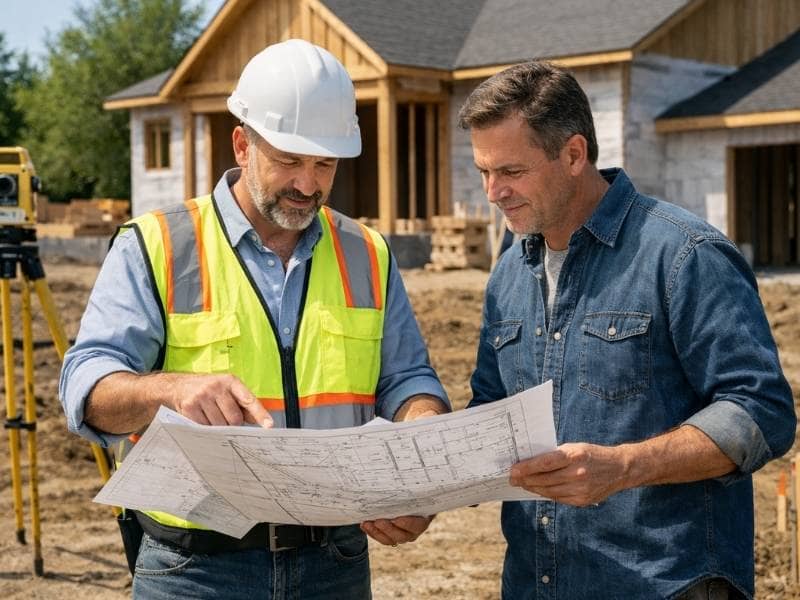
Builders and contractors rely on us to set accurate layout points before construction begins. Getting the measurements right early keeps projects on schedule and helps avoid expensive corrections down the road.
Developers working on subdivisions, commercial sites, or mixed-use projects need surveying support at different stages of the process. We work across those stages, from initial boundary work through construction layout and final plat preparation.
Real estate professionals, attorneys, and title companies also work with us when transactions require current, accurate survey documentation.