
How to Find Property Lines Before Installing a Fence or Shed
Installing a fence or shed seems simple. Pick a spot, get the materials, and start building. But skip one step first and the whole project can go wrong. That step is a property line survey. Knowing where your property ends before you build keeps you from putting a structure on the wrong land. In Birmingham, that mistake can cost more than the project itself.
Most homeowners think they already know where their lines are. They point to an old fence, a row of hedges, or a rough sense of where the yard ends. None of those are legally reliable. A property line survey is the only way to know for certain.
Why Existing Markers Can Mislead You
Fences, hedges, and driveways are not legal boundary markers. They were placed at some point in time, often by people making the same assumption you might make now.
Over the years, those markers shift. Fences lean or get moved. Hedges grow past their original spot. Driveways get widened. None of these changes appear in the county’s legal records.
A property line survey goes back to the legal record. It uses your deed, recorded plats, and physical monuments to find where the boundary actually sits. What you see in your yard may or may not match that.
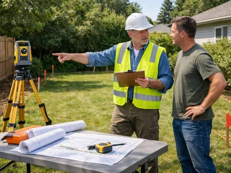
What a Property Line Survey Involves
A property line survey is done by a licensed land surveyor. It is not the same as a quick online search or a measurement you take yourself.
The surveyor starts by researching your property’s legal history. This includes reviewing the deed and checking Jefferson County records. That research shows how the land has been described legally and where any boundary issues might exist.
The survey crew then visits the property. They search for corner monuments, take precise measurements, and compare what they find on the ground to what the records show. If a corner monument is missing, the surveyor figures out where it should be and places a new one.
At the end, you get a sealed survey document showing your confirmed property lines. That document is legally valid. You can use it for permits, neighbor disputes, or any future transaction.
Birmingham Fence Rules You Need to Know
In Birmingham, a zoning permit is required before any fence or wall goes up on any property within city limits. This applies to all fences, no matter the height or material.
The city also sets height limits for residential properties. Front yard fences cannot exceed four feet. Side and rear yard fences can reach up to eight feet. For taller fences in the side or rear yard, there must be at least a five-foot setback from the neighboring lot line.
Your permit application needs a site plan showing where the fence will sit in relation to your lot lines. That is why a property line survey should come before the permit, not after.
Properties in a floodplain or historic district may need extra reviews before a fence permit is approved.
What About Sheds?
Sheds follow different rules than fences in the Birmingham area. In unincorporated Jefferson County, a building permit is required for any accessory structure 200 square feet or larger. Smaller sheds may not need a permit, but they still must meet setback requirements for your zoning district.
Those setback rules tell you how far the shed must sit from your property lines. Without a confirmed property line survey, you have no reliable reference for placing the shed correctly. A shed too close to the boundary can be flagged during inspection, require relocation, or start a dispute with a neighbor.
Check your specific zoning district requirements before you build. The rules vary depending on whether your property is in the city of Birmingham, unincorporated Jefferson County, or a surrounding municipality.
Why Calling 811 Is Also Part of the Process
Before any digging, Alabama law requires homeowners to call 811. This is the state’s utility locate service. It sends technicians to mark buried gas, water, cable, and power lines on your property.
A property line survey does not find underground utilities. The two services work together. The survey shows where your legal boundary is. The 811 call shows what is buried below the surface. Both steps should happen before any post goes into the ground.
Frequently Asked Questions
Can I find my property lines online without hiring a surveyor?
County GIS maps and online parcel viewers give a general picture of where your property sits. But they are not precise enough for construction or legal purposes. Online maps can contain errors and do not reflect what is actually on the ground. A property line survey by a licensed surveyor is the only legally reliable method.
What if my neighbor already has a fence close to the line?
A neighbor’s fence is their structure, not a boundary marker. It may or may not sit near the actual property line. Get a property line survey done before you build. If the survey shows the fence crosses onto your land, you will have documentation to address it properly.
Does Birmingham require a survey as part of the fence permit process?
Birmingham requires a site plan showing the fence’s location relative to your lot lines as part of the zoning permit application. A property line survey is the most reliable way to produce that accurately. Without confirmed lines, the site plan is based on an estimate.
How close to my property line can I build a shed?
Setback requirements depend on your zoning district and whether your property is inside city limits or in the county. A licensed surveyor confirms your property lines. Your local zoning office provides the specific setback distances that apply to your situation.
Will a property line survey show easements that might affect where I build?
Yes. A property line survey identifies recorded easements on the property. Easements limit what can be built in certain areas. A fence or shed placed across an easement can be required to come down. Knowing where easements are before you build helps you avoid that problem entirely.