
What Does a Land Surveyor Actually Do for Homeowners and Builders?
Most people have a general idea that a land surveyor has something to do with measuring property. But the work goes much further than that. A land surveyor reads legal records, locates physical evidence on the ground, and produces documents that carry real legal authority. For homeowners and builders, understanding what that work looks like helps you know what to expect and why each step matters.
Reading the Property’s History First
A surveyor does not show up at a property and start measuring right away. The first task happens in the office, not the field.
Before visiting any site, a surveyor pulls the property’s deed, reviews any recorded plats, checks Jefferson County records, and looks up prior survey documents. This research builds a picture of how the land has been described legally over time. It can also reveal problems that are not visible on the ground, such as easements recorded decades ago, gaps in ownership history, or overlapping descriptions from neighboring parcels.
This step is what separates a licensed surveyor from someone simply taking measurements. The legal history of a parcel directly affects where the boundary lines belong. That history has to be understood before any field work begins.
Finding Evidence on the Ground
Once the research is done, the survey crew visits the property. Their job is to find evidence. That evidence comes in several forms.
Physical monuments are the most direct. These are markers, usually metal pins, iron rods, or concrete posts, that previous surveyors placed to mark corners and boundary lines. Finding them confirms where lines were established. Missing or disturbed monuments are just as important to note because they signal that extra work will be needed to sort out the boundary.
The crew also looks at occupation evidence. This includes fences, walls, hedges, and driveways that property owners have maintained over the years. In older Birmingham neighborhoods, where lot lines were established long ago, occupation evidence and recorded deed lines do not always match. Those gaps are something a licensed surveyor must carefully evaluate and document.
Field measurements are then collected to verify distances and angles between monuments and other reference points. Every measurement gets checked against what the office research showed. When the evidence and the records agree, the surveyor can state the boundary with confidence. When they conflict, those conflicts have to be resolved before the final document is produced.
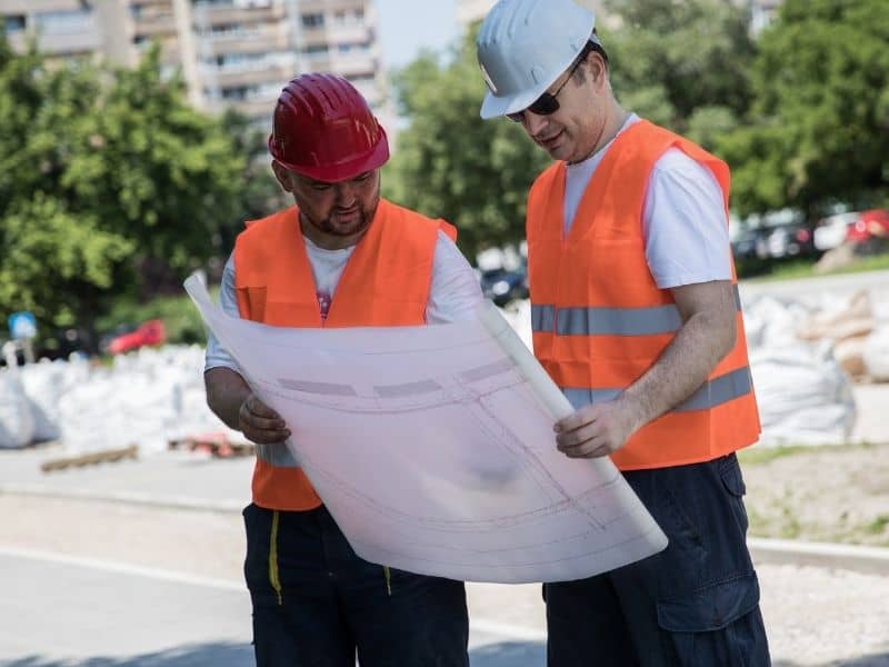
Setting Corners and Marking Lines
After reviewing all the evidence, the surveyor physically marks corners on the ground. This is called setting monuments. New iron pins or rods are placed at the exact points the surveyor has determined to be the legal corners of the property.
For homeowners, this is often the most visible part of the process. Those small flags or stakes you see along a property line after a survey has been done are markers placed by the crew. They show you exactly where your legal boundary sits, giving you a clear reference before any construction, fencing, or landscaping begins.
For builders working on new homes and developments across Birmingham, this step is critical. Knowing exactly where the corners are allows a contractor to position a foundation, driveway, or any other structure in the right place. Structures built too close to a boundary line can violate local setback rules, which can cause permit problems or force costly changes later on.
Producing the Legal Document
Everything the surveyor finds in the office and the field gets compiled into a final document. For most residential projects, this is a plat or survey map. It shows the shape and dimensions of the property, the location of monuments, any easements or encroachments found, and the surveyor’s professional seal and signature.
That seal is what gives the document its legal standing. In Alabama, only a licensed Professional Land Surveyor can place that seal on a document. It tells every party who relies on it, whether a lender, a title company, a permitting office, or a court, that the work meets a professional and legal standard.
How the Work Differs for Homeowners and Builders
The core process is the same for both groups, but the focus shifts depending on the project.
For homeowners, a surveyor is usually answering a specific question. Where is my property line? Does my neighbor’s fence cross onto my land? Can I add a structure in this part of my yard without breaking a setback rule? The survey produces a clear, documented answer.
For builders, a surveyor plays a role at multiple stages. Before construction begins, the surveyor confirms the legal boundaries and the buildable area of the site. During construction, the surveyor may return to place stakes that guide where foundations, utilities, and structures are built. After construction, a final survey may be needed to confirm that everything was built where it was supposed to be.
Frequently Asked Questions
What is the difference between a surveyor and a contractor?
A contractor builds structures. A surveyor determines where those structures can legally be placed. Contractors are not trained or licensed to read deed records or establish legal property boundaries. Relying on a contractor to mark your lot lines is a common mistake that can lead to setback violations and legal disputes.
Can a surveyor help settle a disagreement with a neighbor over a boundary line?
Yes. A licensed surveyor can research the legal history of both properties, locate existing monuments, and produce a document showing where the boundary legally sits. That document carries legal authority and is often enough to resolve the dispute without going to court.
What happens if a property corner cannot be found?
When a corner monument is missing, the surveyor uses deed records, neighboring monuments, and field measurements to calculate where the corner should be. A new monument is then set at that location, and the process is fully documented in the final survey.
Do builders need a new survey for every project?
Not always, but a current survey is strongly advisable before new construction begins. Older surveys may not reflect changes to the property or updated records. A surveyor can review an existing survey and let you know whether it is still valid for the project.
Why do lenders and title companies sometimes request their own survey?
A seller’s survey may be outdated or may not cover everything the lender or title company needs to check. Changes to the property, new easements, or encroachments that happened after the original survey was done will not show up on an older document. A current survey protects everyone involved in the transaction.